Lots of people tell me that they don’t understand ‘Twitter’ as a vehicle for social media or that they don’t see the point of it. I try to explain that it is a way of either disseminating information to a greater audience or indeed filtering back information from the millions of tweets sent every day to find something for your own interest.
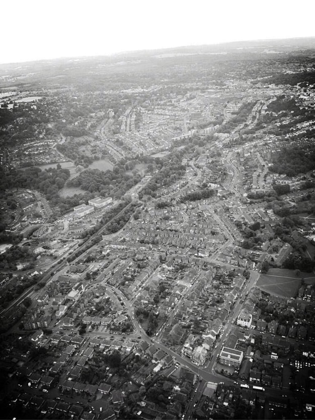
And every now and then it throws up a real gem such as the aerial image below that was taken by @NPAS_Redhill (the National Police Air Service based at Redhill) on the 11th September 2013.
Looking at the photo you can see that this is the view looking south over modern day Highbrooms, the major road in the foreground is Highbrooms Road with the one way system with Stewart, Gordon and Wolseley Roads spurring off and the Brick Works Freehouse standing in the island (@the_Brick_works). To the right of this you can see St Matt’s Church (@stmattschurch) at the end of Gordon Road and then the large white building which used to be the Longbow pub, now Longbow Court, standing on Colebrook Road just below the green on the corner of Southview and Colebrook Road with footpaths diagonally crossing it.
In the middle ground on the left side of the photo and adjacent to the train line you can just make out the metal cage of the dis-used gas works, this is currently being dismantled (see earlier blog posts) and won’t be there much longer so its great that this photo has been taken with it still in place. The roads running from left to right across the photo are Holmewood, Cambrian and Dynevor Road, all joining up with Woodland Road.
Further south you can see across the wooded and open areas of Grosvenor and Hilbert Park to the left and Silverdale Road stretching back up the hill towards Queens Road and Stephens Road and reaching further into the St Johns area of Tunbridge Wells on the centre and right.
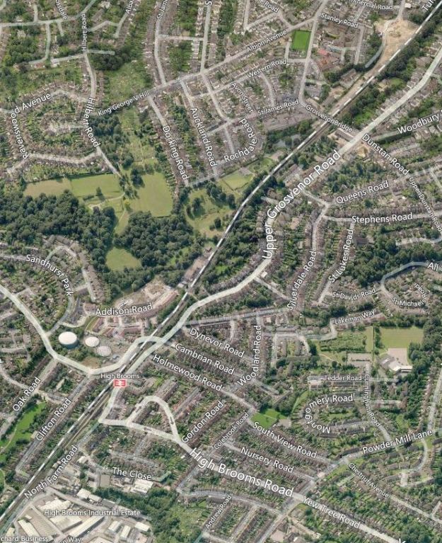
If you are struggling to see all of this it may be easier if you use the annotated image below although it is at a slightly different angle of view but the best that I could do quickly.
If you have something to contribute to this blog, or just want to let me know you are enjoying it feel free to comment below, email me at HighbroomsSociety@gmail.com or send me a message on twitter to: @HighbroomsSoc
Copyright for all images belongs to Daniel Marsh @danieljmarsh unless otherwise stated – please do not replicate or use in any form without prior permission being granted.

